Click here for the Map of the National Register of Historic Places in Plymouth
Plymouth Center – National Register of Historic Places – Designated by the National Park Service in 1999
Watch the video about Plymouth Center here:

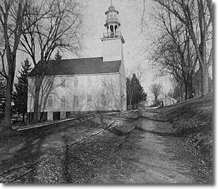
A sugar maple frames the historic Congregational Church
on the Plymouth Green.
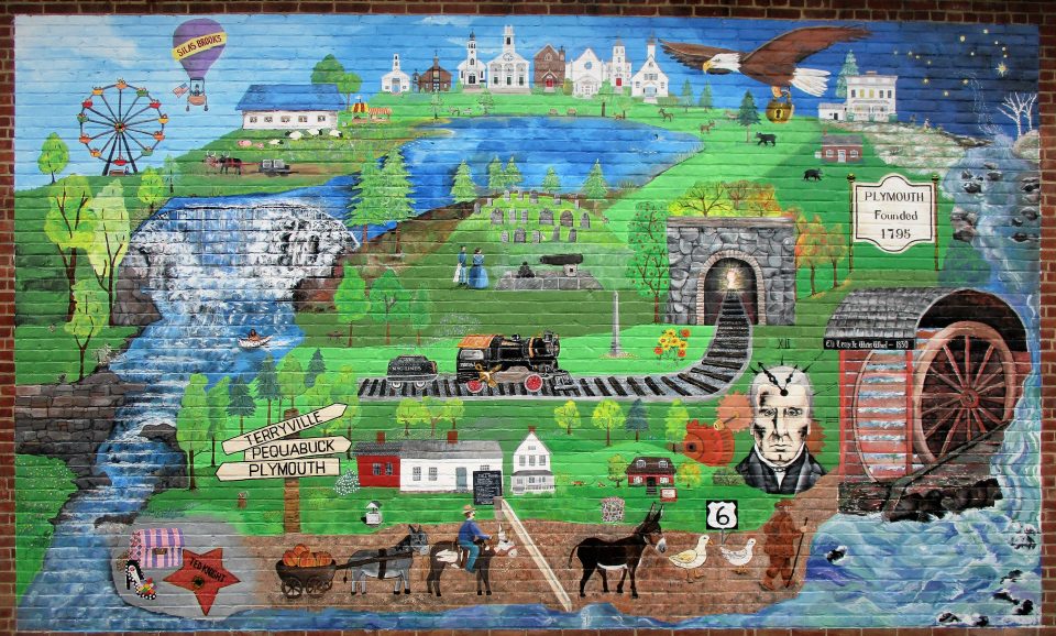
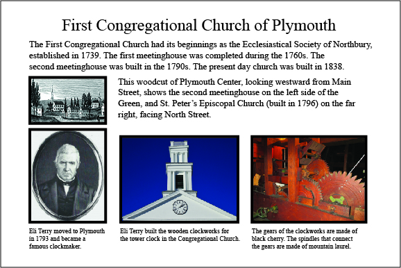
In the early 1700s, the area of what is now Plymouth and Thomaston was called Northbury. In 1747, the Ecclesiastical Society of Northbury acquired four acres of land to be used for a meetinghouse, a training ground for the local militia to ward off Indian attacks, and a cemetery. This land became the center of the village of Plymouth. The present day Congregational Church was built in 1838. Eli Terry, innovative clockmaker and Plymouth resident, built the wooden clockworks that still run the clock today.
Eli Terry introduced the concept of the mass production of interchangeable parts, namely the wooden gears in clocks. Prior to this, gears were laboriously made individually by hand.
Terry figured out how to use water power to cut the gears so they turned precisely with the other parts. If a gear broke, it could be easily replaced with an identical one.
His water-powered clock factory was at Greystone Falls, in the south end of Plymouth, near the Waterbury town line, where Hancock Brook flows over a steep ledge.
His big moment came in 1807, when he signed a contract with two men from Waterbury, Levi and Edward Porter, to produce 4,000 clocks in three years. This was unheard of at the time. Terry was ridiculed because for the first year, he produced no clocks, but spent all his time making machines and figuring out the best way to set them up. But by 1810, he fulfilled the contract, and went on to become quite wealthy.
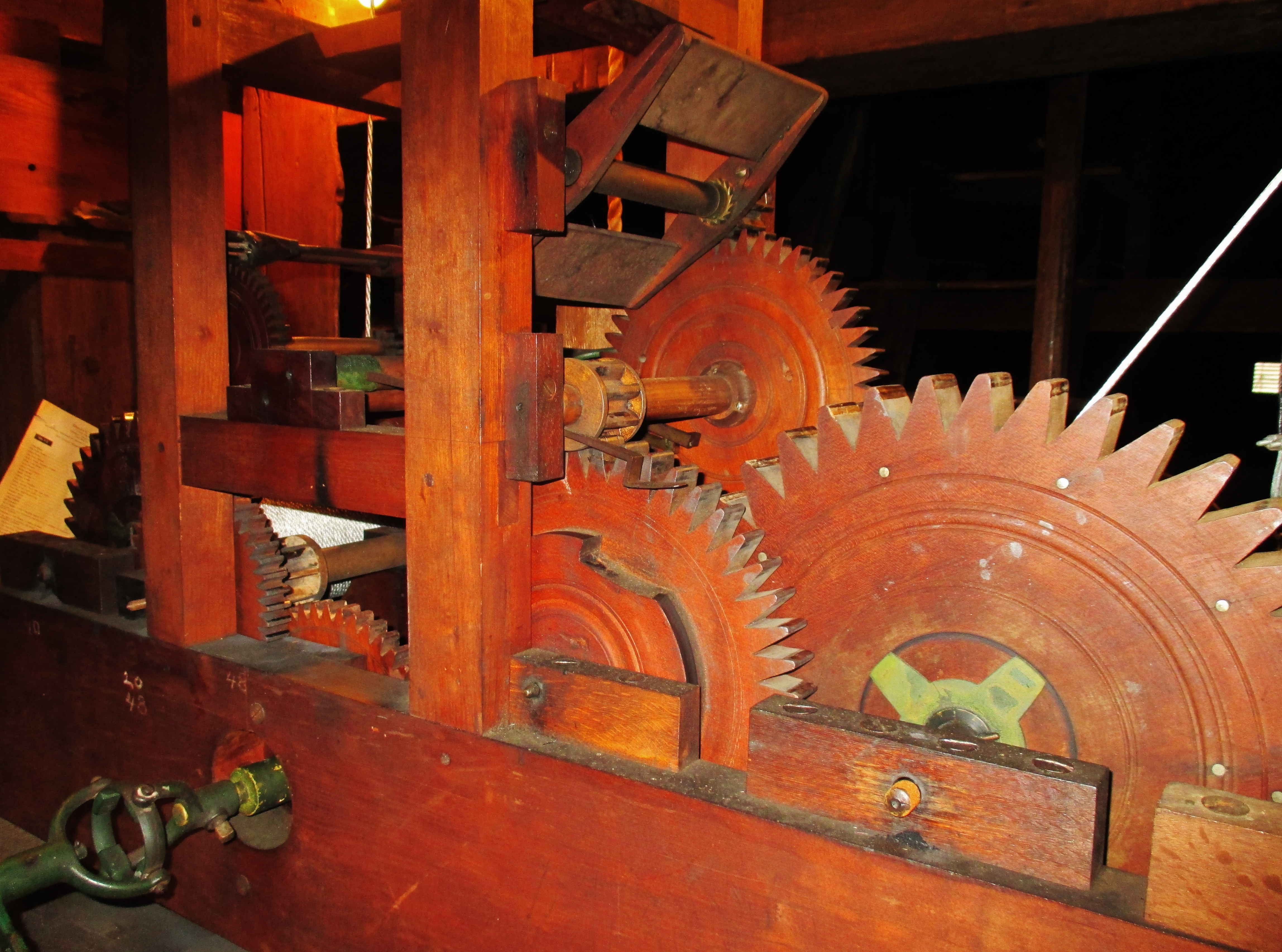
The wooden gears of the tower clock in the Plymouth Congregational Church were built by Eli Terry.
.
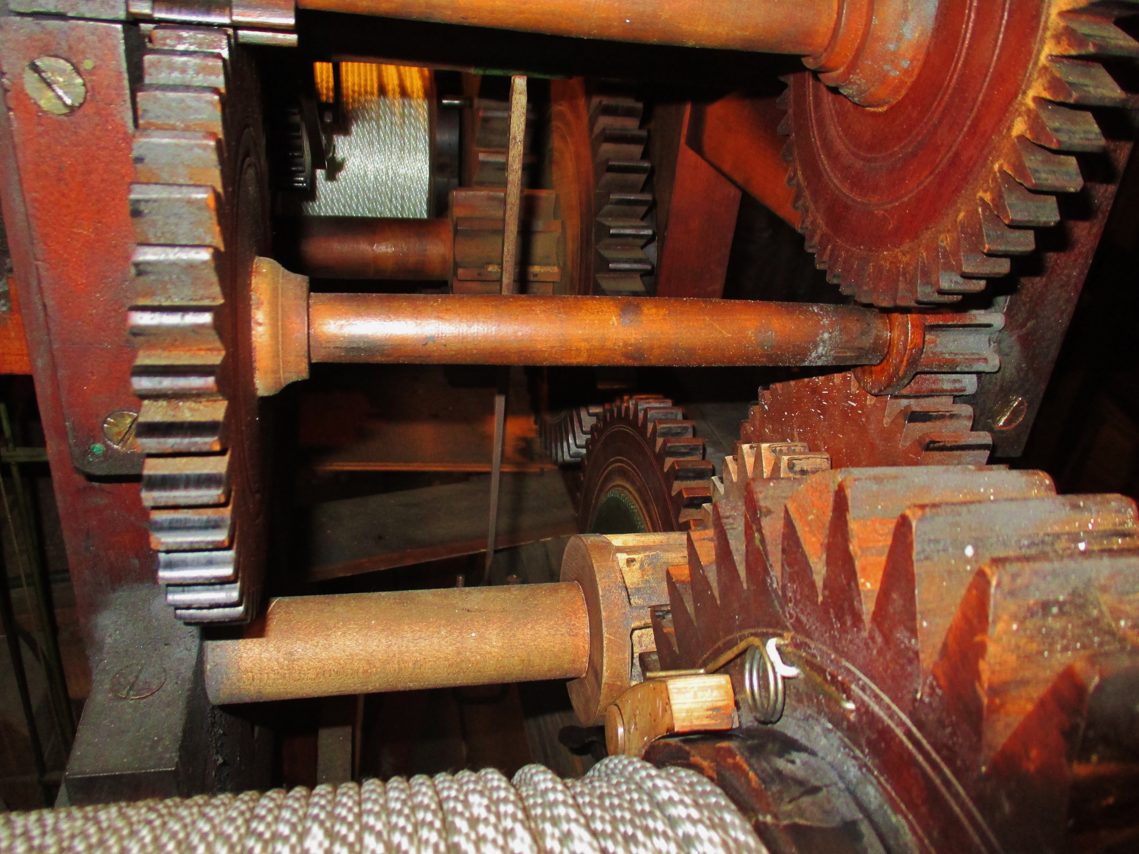
Wooden clockworks built by Eli Terry.
.
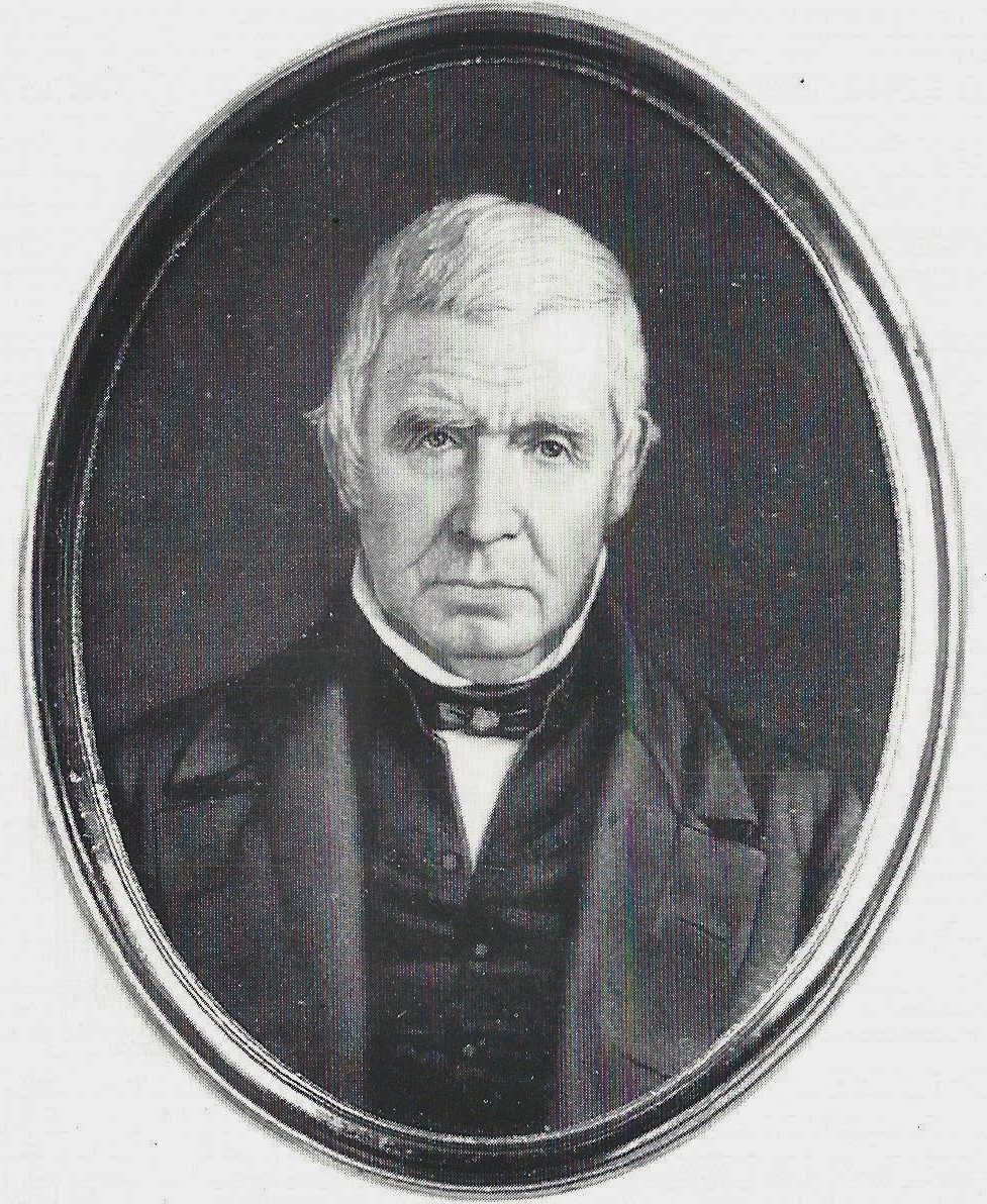
Eli Terry, early 1800s Plymouth clockmaker who revolutionized the clockmaking industry in America.

.
Take a stroll in the village of Plymouth Center, listed in the National Register of Historic Places.
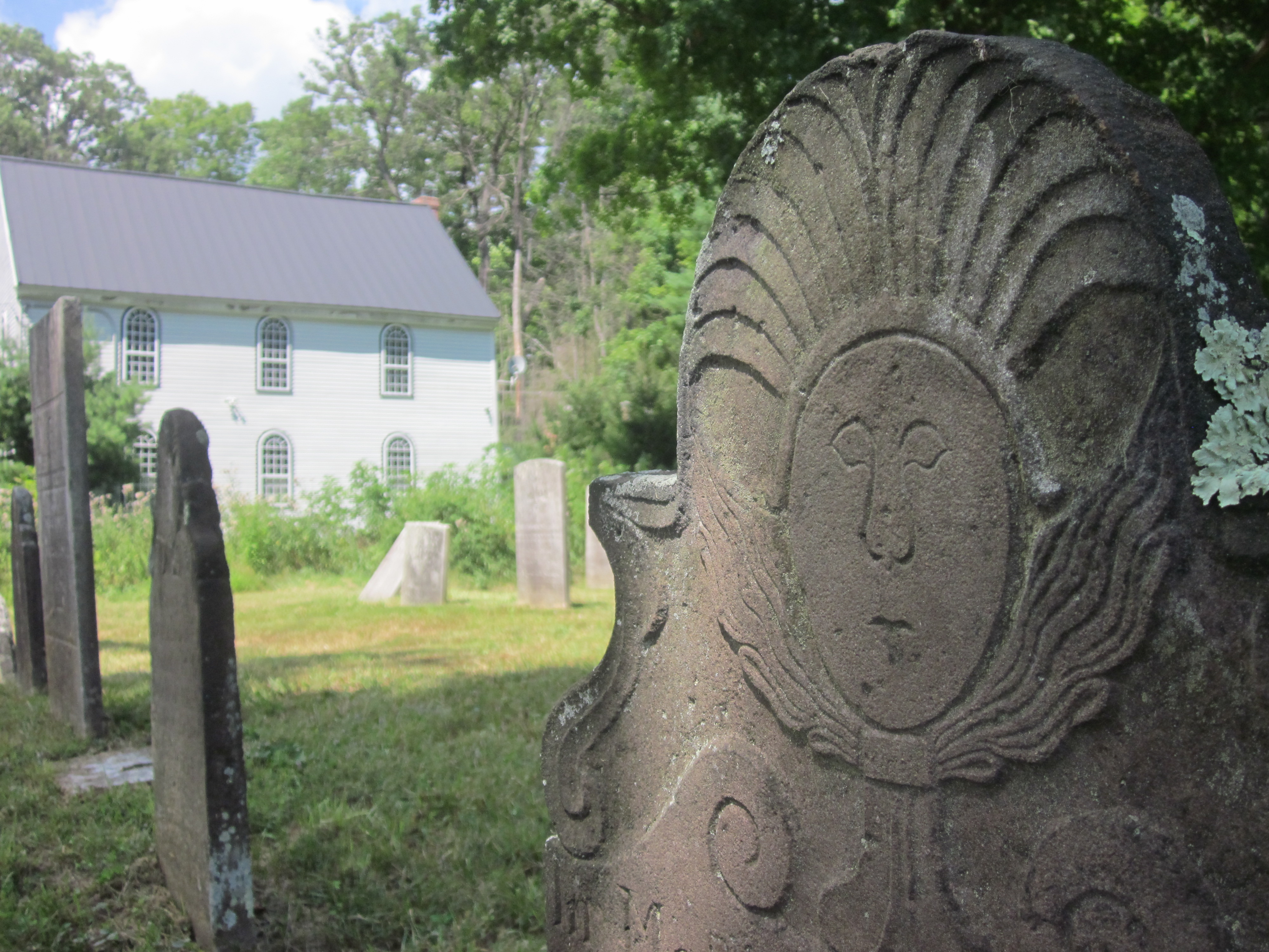
A self-guided walk features the Burying Ground, with gravestones of 38 soldiers from the Revolutionary War. In addition to their original monuments, all the veterans also have a modern rectangular granite slab with their name and military unit.
The carved inscriptions on many of the gravestones provide clues to life in colonial Connecticut; such as “lived to bury five husbands”, or “died of scald”. The tour passes by a house, originally owned by Major David Smith, an American officer in the Revolutionary War. In September 1780, George Washington stayed here on his way to meet the French General Comte de Rochambeau in Hartford. The tour also includes the Greek Revival Congregational Church, built in 1838, and a house that was a stop on the Underground Railroad. The Plymouth Land Trust’s Carriage Shop Trail is also nearby. www.plymouthlandtrust.org
Click here for the Walking Tour of Plymouth Center brochure
Click here for a list of Revolutionary War soldiers at the Burying Ground
Click here for the Plymouth Burying Ground gravestone map
Click here for the list of people buried at the Plymouth Burying Ground Courtesy of Len Alderman, Burlington Town Historian
The GPS coordinates of Plymouth Center are N41.67221, W73.05344
There are 38 soldiers from the Revolutionary War laid to rest at the Plymouth Burying Ground.
Scavenger Hunt of the Plymouth Green – for kids of all ages!
Walk around the Green and learn about the history of Plymouth by taking part in the scavenger hunt!
Click here SCAVENGER HUNT April 2016
HISTORICAL SIGN INSTALLED on the Plymouth Green
Interpretive sign outside Plymouth Congregational Church on the Green
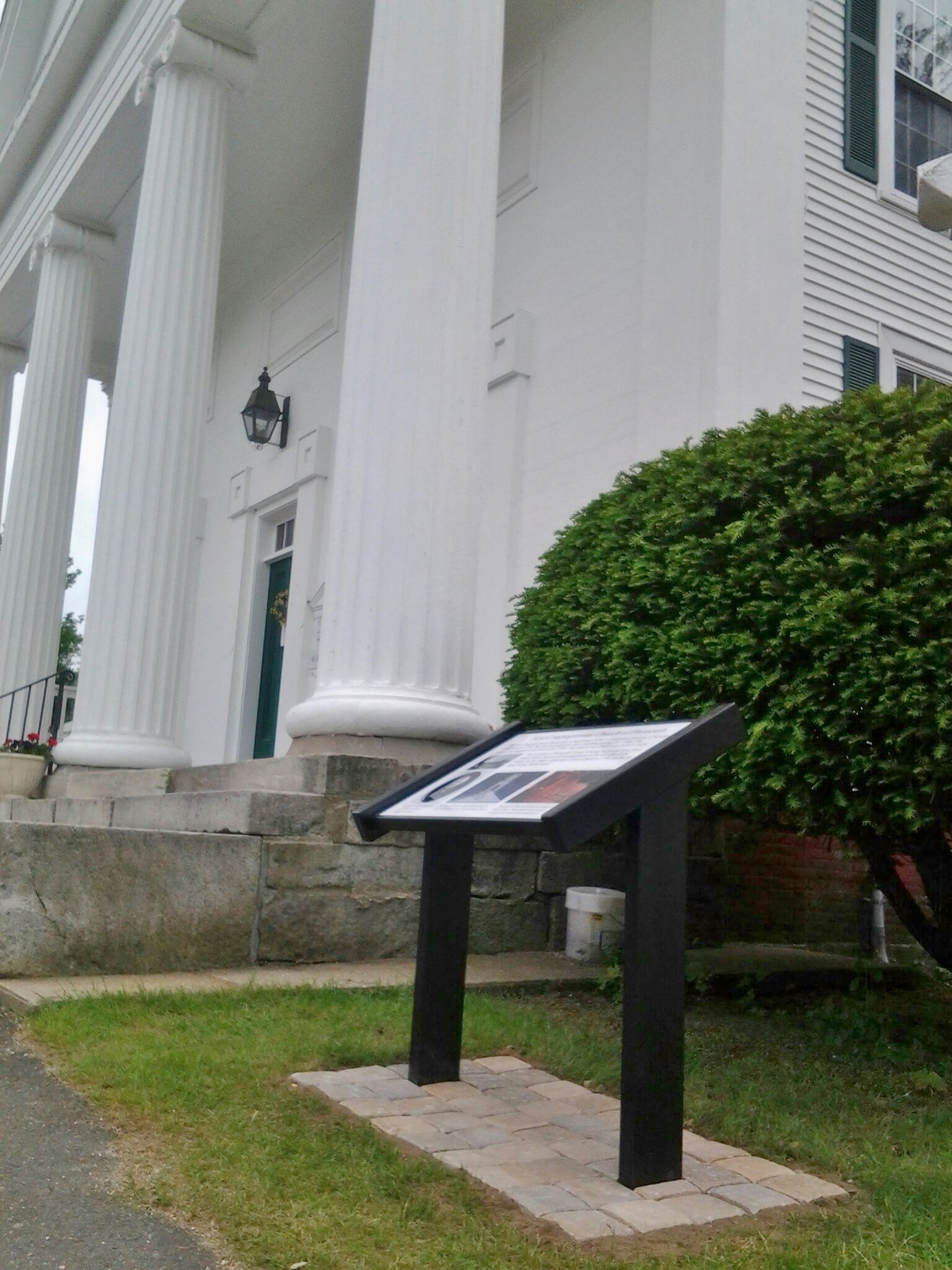
Interpretive sign installed as part of the celebration of the Congregational Church’s 275th anniversary.
There are two other interpretive signs on the Green.
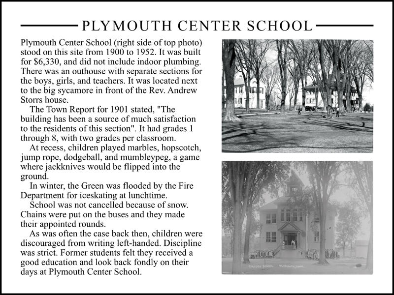
The first sign is in front of the Burying Ground, on the site of the original Plymouth Center School.
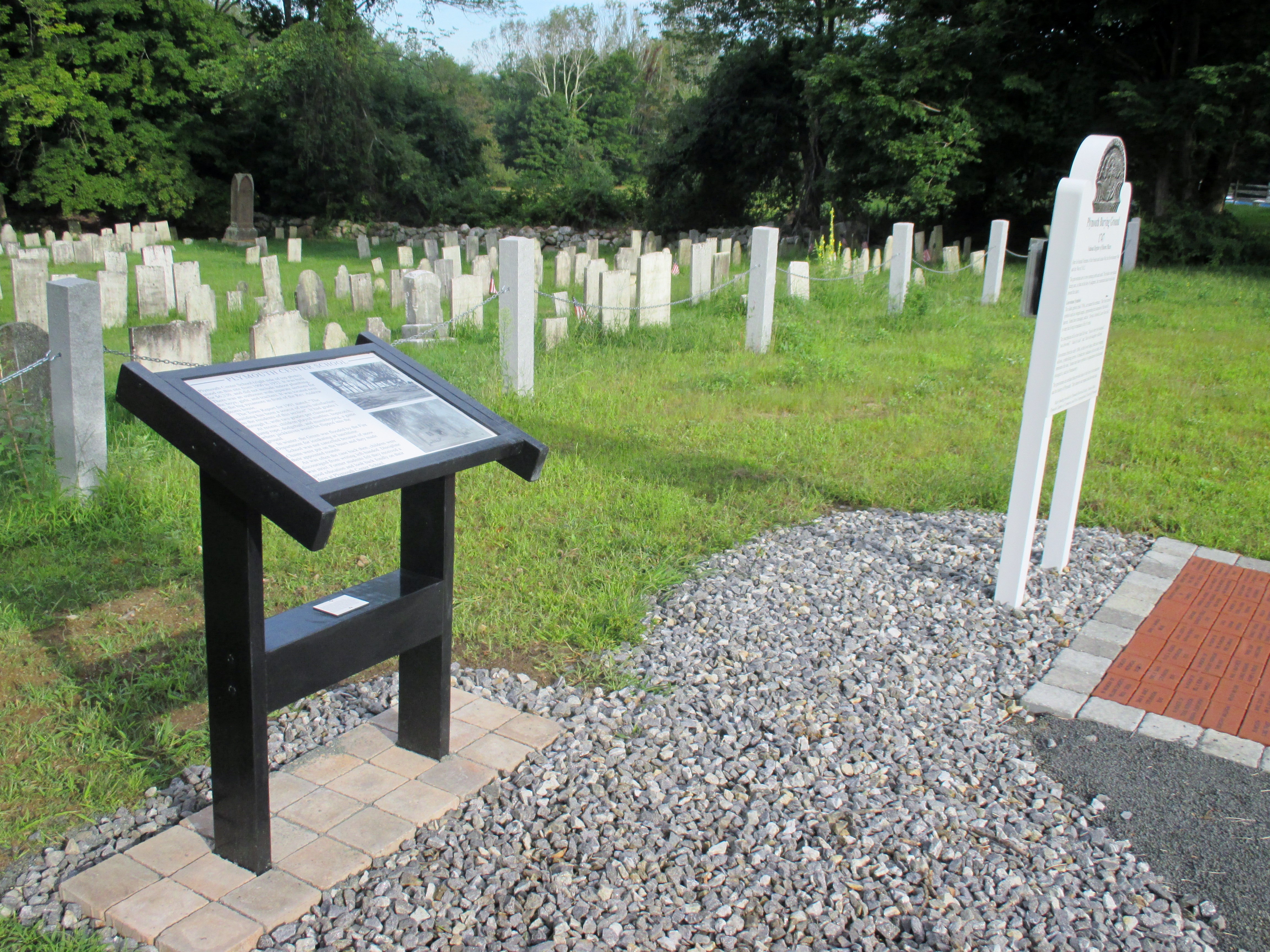
Interpretive sign for the original Plymouth Center School
.
.
.
.
.
.
.
.
.
Plymouth Center School interpretive sign
.The second sign is near the intersection of Park Street and North Street, at the site of the original St. Peter’s Episcopal Church.
St. Peter’s Church, shown below, was built in 1796 on the northeast corner of the Green. The photo is looking up North Street from Main Street. St. Peter’s Church burned down in 1915 and was rebuilt that same year on the east side of North Street, closer to Main Street. This time, it was built of fieldstone and is now the First Baptist Church of Plymouth.
St. Peter’s Episcopal Church, built in 1796.
.
.
.
.
.
.
.
.
.
..
DID YOU KNOW? The stone planter on the Green used to be filled with spring-fed water. It quenched the thirst of oxen and horses after they climbed the steep hill on Main Street coming from Thomaston. The Town report of 1901 stated that “$6 was appropriated to Addison Bunnell for care of water tub at Plymouth Center”.
.
GUIDED TOURS of PLYMOUTH CENTER
We offer one hour guided tours of Plymouth Center and the Burying Ground for seniors, youth groups, school classes, home schoolers, and historical organizations. The symbolism on the gravestones provides clues to life in colonial Connecticut. We create a timeline of the early history of our country using the inscriptions of soldiers from the French and Indian War and the Revolutionary War. Engravings such as “died with her daughter stillborn“, “lived to bury five husbands“, “died of scald“, and “Mortals Attend and Learn Your End” make the Burying Ground a fascinating outdoor museum of early American history. Fifth grade classes have taken the tour as enrichment for Connecticut’s Social Studies colonial history curriculum. Teachers and students give it rave reviews.
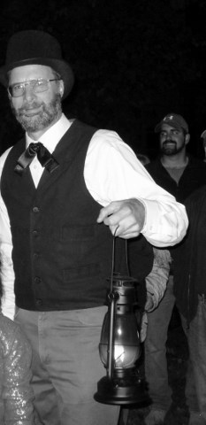
Lantern tours after dark are also a fun way to learn about our history. We can also include the secret tunnel in the Henry Terry House used in the Underground Railroad.
Contact us to arrange a unique tour for your group! Day or night!
.
.
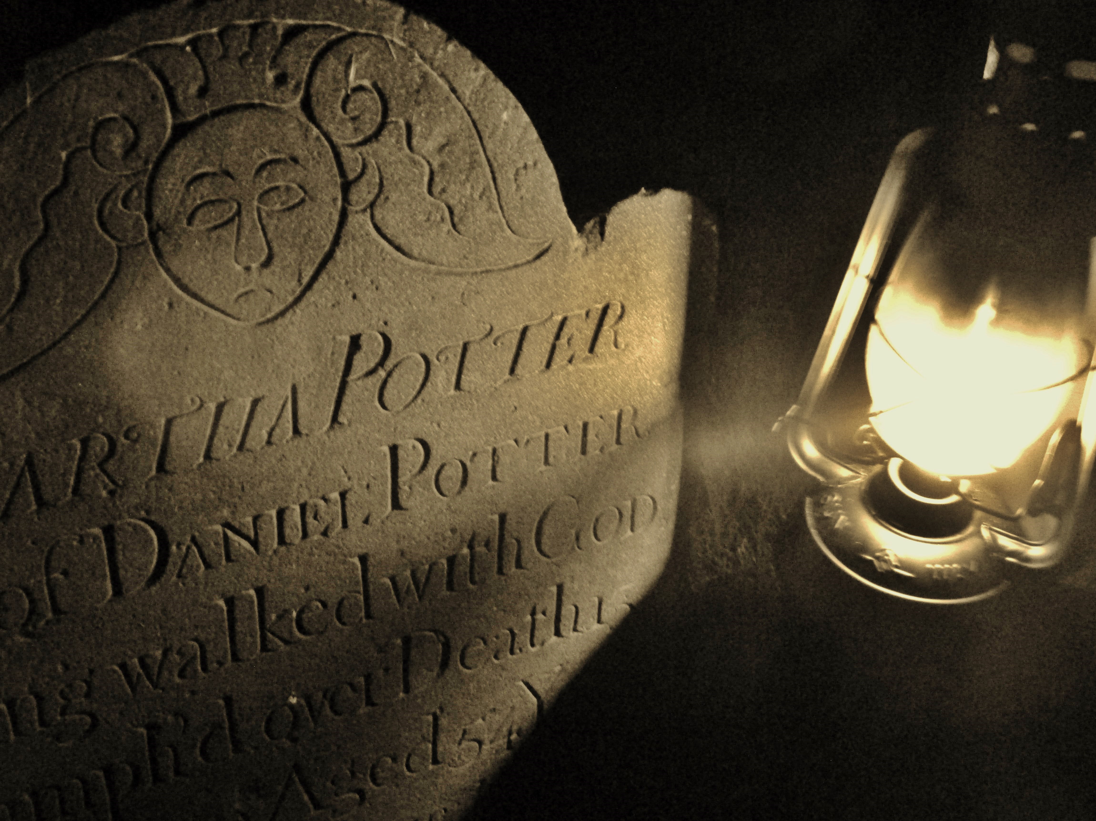
Martha Potter gravestone
.
.
.
.
.
.
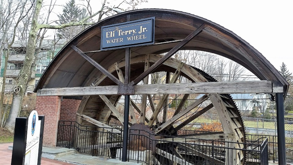
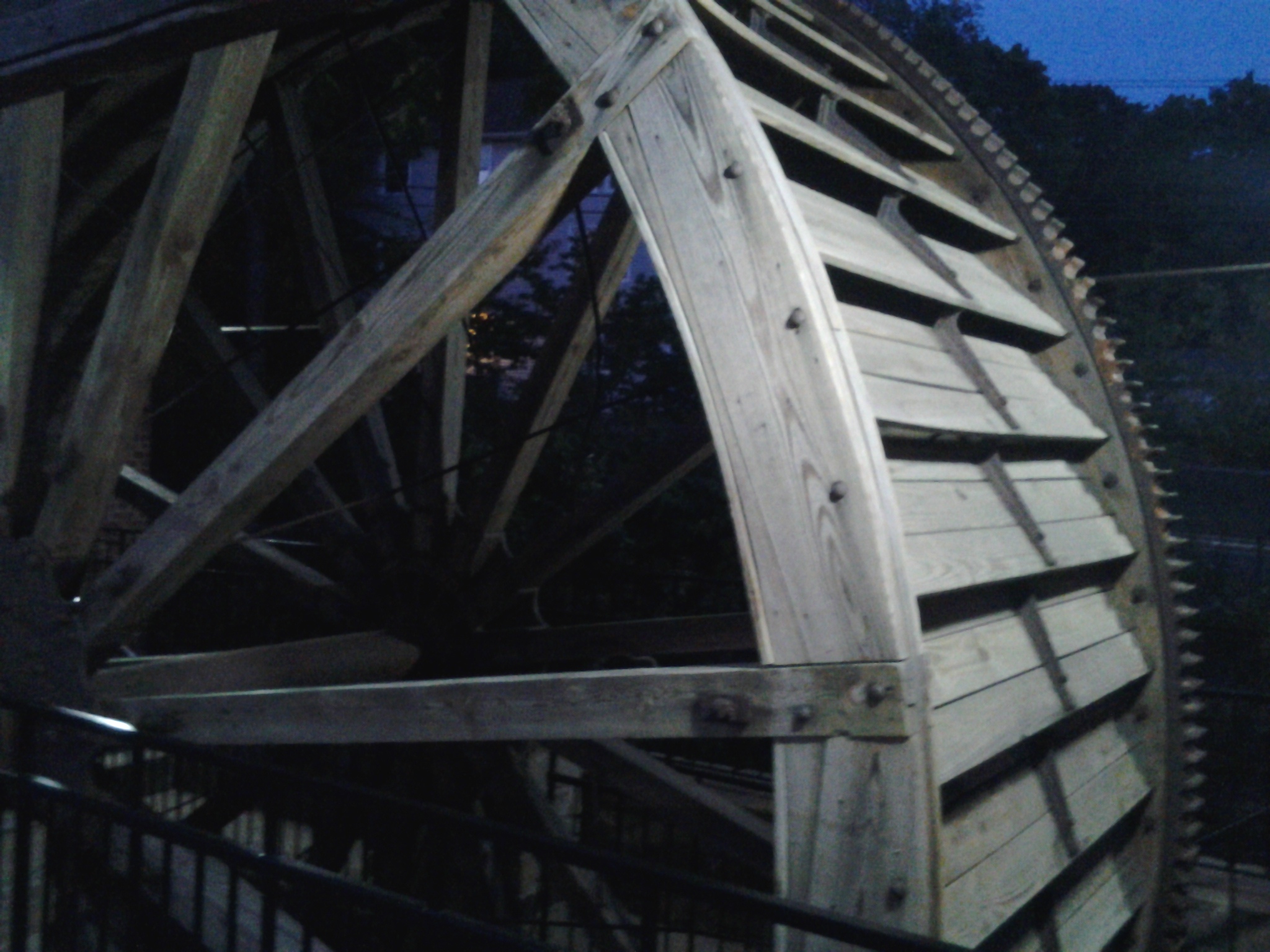
Terryville Waterwheel – National Register of Historic Places – Designated by the National Park Service in 2001
The waterwheel is located at 264 Main Street, Terryville. It is owned by the Historical Society.
.General description
The Terryville Waterwheel is a 20-foot diameter wood and iron waterwheel of pitch-back configuration dating to 1851. The factory that it powered was destroyed about 1940, but the wheel occupies its original site on the west bank of the swift-flowing Pequabuck River on Main Street in the Terryville section of Plymouth. The wheel is protected by a shelter erected in 1996, the roof of which duplicates the curve of the waterwheel. The shelter has brick walls on the west and north sides and is open (except for iron railings) on the east side, facing the river, and the south side, facing Main Street. Originally, the wheel was enclosed by a small gable-roofed building attached to the main mill.
The name of the property, Terryville Waterwheel, was chosen because it best reflects its overall historical significance. Formerly, the wheel was known as the Eli Terry, Jr. Water Wheel, in the belief that it dated from the construction of Eli Terry, Jr.’s clock factory on the site in 1824. That factory, then in the ownership of the Lewis Lock Company, was completely destroyed by fire on September 21, 1851, and immediately rebuilt, presumably including the wheel. Two years later, in January of 1854, the Lewis Lock Company was merged with the James Terry & Company lock company to become the Eagle Lock Company, a company that remained a major employer in Terryville for more than a century.
Significance of the property:
The Terryville Waterwheel is the most nearly intact of the three known 19th-century wooden waterwheels remaining in Connecticut. There are three interrelated components to its significance:
1. It is an evocative monument to Connecticut’s early years of industrialization, when industries from clocks to firearms to textiles relied in whole or in part on waterpower. The consumer-oriented manufacturing that transformed Connecticut from a mostly agricultural state to one of the country’s most industrialized and urbanized societies had many roots: technological innovation, market savvy from the peddler trade and from connections to the New York City-based wholesale sector, and a goodly amount of capital from the state’s successful merchant families. One other factor was essential: the state’s many fast-moving streams and rivers provided sufficient power, at least in the early years, to operate the various innovative machinery that allowed quantity-production to take place. In many cases, the early factories took over sites that had powered the mills of the agrarian economy: grist, saw, and fulling mills, but even when entirely new sites were exploited, the state’s early manufacturing enterprises relied on the waterwheel technology that was developed by small-scale traditional mills.
2. It is a rare surviving example of a once-common type of construction, the wooden waterwheel, that was important not only for powering industry but also for advancing the knowledge and practice of civil and mechanical engineering.
3. Because so few survive, every remaining example has information value . Although it is known from published technical works what the period’s leading authorities thought about the issues surrounding the efficient exploitation of waterpower, it can only be known what occurred in practice by studying actual examples.
Terryville Water Wheel at night.
.
.
.
.
.
Click Here for an Explanation of How the Water Wheel Worked
Terryville Waterwheel National Register of Historic Places report
East Plymouth – National Register of Historic Places – Designated by the National Park Service in 1985
The Tory Story
The quiet hamlet of East Plymouth (originally called East Church) is located in the northeastern portion of Plymouth, at the intersection of East Plymouth Road and Marsh Road, near the Plymouth/Bristol town line. During the Revolutionary War, the residents of this area supported their mother country of England. They were called Tories, or Loyalists. They were faithful to their religion, the Church of England, (also called the Anglican Church). At that time, the King was the head of the Church, so it is easy to understand their feelings. They considered themselves law-abiding citizens of the British colony of America.
Periodically, the local Sons of Liberty would raid the farms and homes of the Tories in East Plymouth. The women would warn the men working in the fields of the attack by blowing into a tin horn or a conch shell. The villagers would run deep into the woods and hide in a rock outcropping known as “Tory Den”. Today, a blue- marked hiking trail (the Tunxis Trail) leads to the site. The trailhead is about 1/2-mile north of the village, and Tory Den is about 1-mile down the Trail.
The Hanging of Moses Dunbar
Moses Dunbar lived in East Plymouth. He was a Tory and a member of the Anglican Church. He was accused of accepting a commission as a captain in the King’s Army, and of enlisting others to do so. He was brought to Hartford where he was put on trial for high treason. Despite his offer to confine himself to his farm if allowed to go free, he was found guilty. His father, a staunch Congregationalist and supporter of the Rebel cause, was said to be willing to provide the hemp to make a noose to hang him. Indeed, Moses Dunbar was hanged on a hill near Trinity College in Hartford, the only Tory to be executed for treason in Connecticut. He left behind a wife and a young family. Shortly afterward, the death penalty for treason was repealed.
Click here for Moses Dunbar biography
After the Revolutionary War, the villagers built St. Matthew’s Episcopal Church, completed in 1794. St. Matthew’s cemetery is next to the church. The oldest gravestone dates to 1795.
The Church is now a privately owned residence.
The GPS coordinates for East Plymouth are N41.70912, W73.00405
Click here for St. Matthew’s Cemetery grave list
St. Matthew’s Cemetery Names-spreadsheet compiled by Gregg Rahuba in May 2014 for an Eagle Scout project
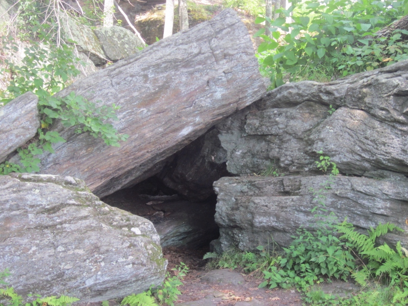
Tory Den – Revolutionary War hide out for Tories from East Church
St. Matthew’s cemetery and the former St. Matthew’s Episcopal Church in background
Click here for the story of Constant Loyal Tuttle’s unusual name! Constant Loyal Tuttle
